Windows
Mac
Windows
Log in / Sign up
Windows
›
Tags › satellite map
Most popular
Satellite Map
software
Relevance
Popularity
Rating
SatPC32
258
Erich Eichmann, DK1TB
SatPC32 calculate the tracks of earth orbiting...
of earth orbiting
satellites
. The calculations...several selected
satellites
within a world-
map
CompeGPS AIR
135
CompeGPS TEAM S.L.
CompeGPS AIR enables users to create and edit flight routes...
to any kind of
maps
such as opographic, vector
Crash Zone
100
The CAD Zone, Inc.
Crash Zone is a drawing program for accurately mapping crash scenes...
drawing program for accurately
mapping
crash scenes...3D graphics,
satellite
image clean-up
Map Export
68
OfflineSoft
Map Export is a GIS developer oriented tool for downloading and exporting background image. For a long time...
been changed. Google
Map
provides...
satellite
imagery and street
maps
from Google
Map
Easy Yahoo Maps Downloader
46
getallmaps.com
Easy Yahoo Maps Downloader lets you download map images. This app lets you specify...
choose between two
map
types (
satellite
or
map
) and select a zoom
Global Overlay Mapper
free
26
MapAbility
Each map has a background, 12 active layers, and custom Scalebar. 2204 Major Cities - Europe:323, Asia:517, Africa...
enthusiasts, including : 1 World
Map
, with specialised
satellite
images
Tech-Pro World Clock
25
Tech-Pro Limited
Tech-Pro World Clock 2 is a Windows desktop accessory that shows the date and time on a world map. It helps you keep track...
world on a
map
. The
map
can...from recent weather
satellite
images. The
map
is resizable
Moagu
17
Moagu
Moagu: The Mother Of All GPS Utilities. You can convert USGS topographic maps...
maps
, aerial/
satellite
imagery, and any other raster
map
...GPS units. Garmin
maps
GeoAze3
14
Silverglint
The GeoAze3 geography game is a fun way to learn geography. The program features geographical information...
displaying your chosen
map
is launched...and stunning
maps
based on
satellite
imagery)
Leopard
13
Brandon Watts / WeatherBug
First, use the Leopard User Guide to help you write code for your weather program. Choose to display...
temperature, wind speed, radar
maps
,
satellite
images and more! Once
DESCW
free
13
Earth Esa
DESCW (Display Earth remote sensing Swath Coverage...
to display Earth Observation
satellites
(ERS-1, ERS-2 ...over the Earth
Map
. It will help
MapToaster Topo/NZ
11
Integrated Mapping Ltd
MapToaster Topo New Zealand is New Zealand's only topographical mapping suite...
only topographical
mapping
suite ...integrated aerial and
satellite
imagery with transparent
CacheMagnet
free
9
Brian Erickson
With CacheMagnet, you can read and display contents of .GPX or .LOC files, download waypoints...
the
map
, view cache
map
in street,
satellite
...
satellite
mode, or hybrid. The hybrid
map
Trellian WorldTime
free
9
Trellian Limited
World Time is a simple to use but intelligent graphical utility that displays...
Enable/disable shadow
map
. Display
satellite
cloud
maps
. Show recent earthquake
TatukGIS AIC
9
TatukGIS
The AIC is an easy to use, stand-alone photogrammetry product designed to rectify...
mosaic aerial photographs,
satellite
images, or raster
maps
to a geographic
Catfood Desktate
8
Catfood Software
Catfood Desktate is an eye catching earth simulator that combines satellite imagery and near...
or fix the
map
on one location...layers include composite weather
satellite
cloud images (updated
WW2D
free
5
Vitaliy Pronkin
WW2D allows you to explore Earth using satellite imagery, topographic maps...
explore Earth using
satellite
imagery, topographic
maps
and image
RealMeteo
4
RealMeteo
It is a friendly realtime interface that shows weather images. Realmeteo has a wide database of weather satellite images...
wide database of weather
satellite
images link...database of weather
satellite
image links
TerraClient
free
3
Bill Friedrich Software
This map overlay option has been designed to help...
over the
satellite
photos. This
map
overlay option...in the
satellite
photos. All
map
and photographic
Pinpoint 8 Desktop Weather
free
3
BIA Information Network
The WVLT Volunteer TV online station provides interactive weather maps...
provides interactive weather
maps
, regional...well as State
Satellite
1
2
3
4
5
6
7
Tags
Satellite
Maps
Map
Earth
Program
Download
World
Weather
Software
Desktop
Featured stories
See all
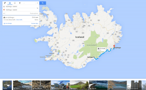
More Opportunities For Trips With Google Maps
Google Maps has recently released a new set of features that will definitely improve user traveling experience.
Mind Mapping Tools: Not To Lose Bright Ideas
Here goes a list of mind mapping tools that will surely help visual thinkers avoid half-concepts and patchy schemes while brainstorming.
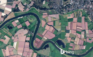
New Bing Maps Preview Focuses On Travelling Plans
Bing Maps Preview has just been updated with a few features that make planning your trips much more convenient.
Halo 5's map editor is now available for free in Windows 10
Unfortunately, Microsoft didn't give us any official information about when or if the game itself will be coming to Windows 10.
Draw on Windows Maps
The default Maps app that Windows offers gives you some very handy drawing options. Here's everything that you need to know about it.